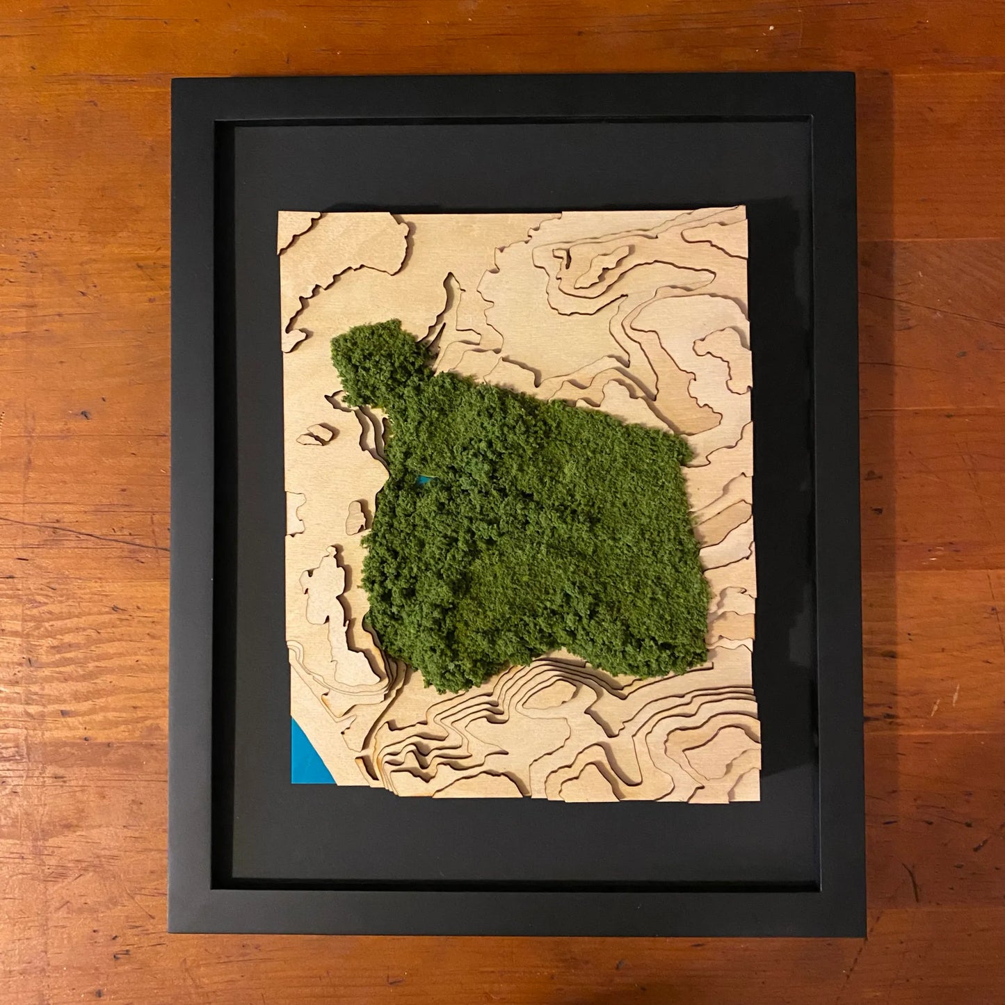
Schenley Park Topographic Map with Fuzz
Schenley Park Topographic Map with Fuzz
Couldn't load pickup availability
The second largest of Pittsburgh’s regional parks, Schenley Park is comprised of 300 acres. It opened in 1889 and is listed in the National Register of Historic Places as a historic district
Product Info
Our highly-accurate topographic maps are made by cutting out layers of wood and then stacking them one on top of the other to reveal the true-to-life relief of the landscape. The finished wood is then mounted to a teal backer. Our delicate groundcover is adhered to show the park boundaries.
These maps are professionally framed on a black backer using all acid free, archival quality materials in an 11″x14″ modern black frame without glass so the viewer can get up close to the topographical details.
Because these maps are handmade out wood, the grain pattern will vary from one map to another and we encourage you to avoid hanging them in direct sunlight or potentially damp areas.
Share